If you are interested in having your property evaluated using remote sensing imagery please reach out to us here.
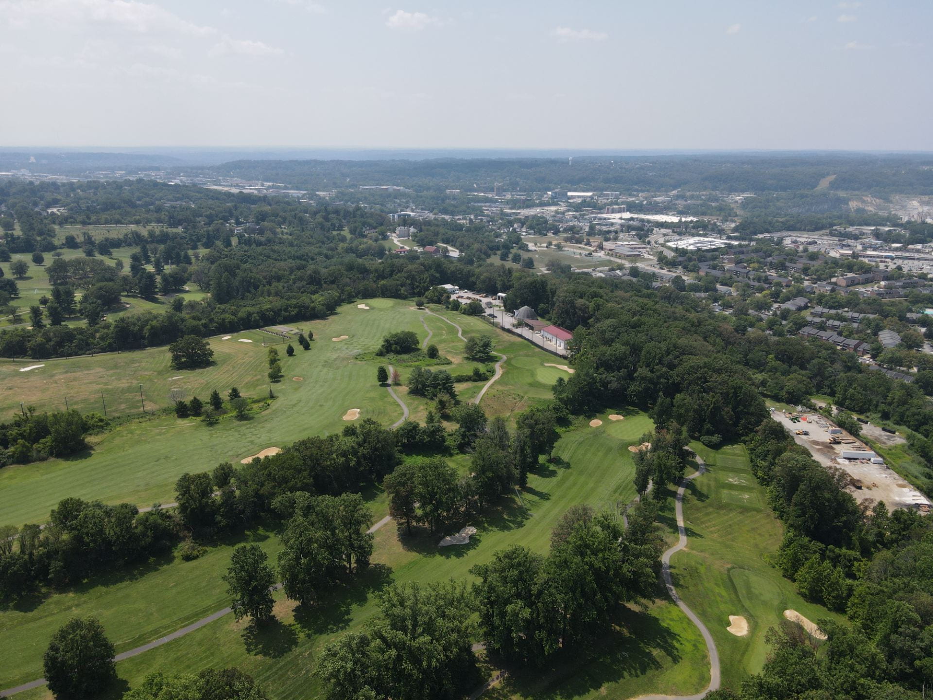
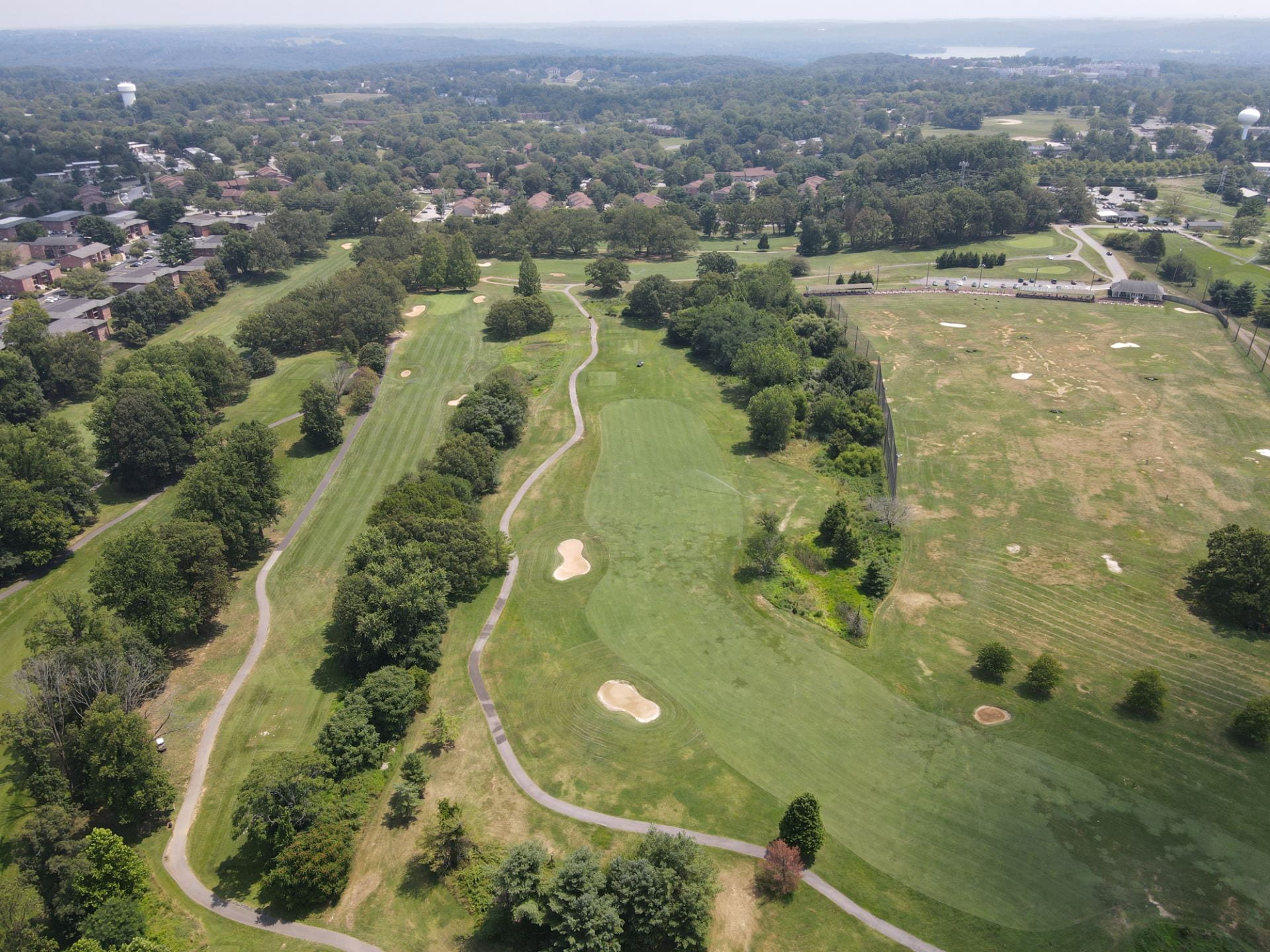
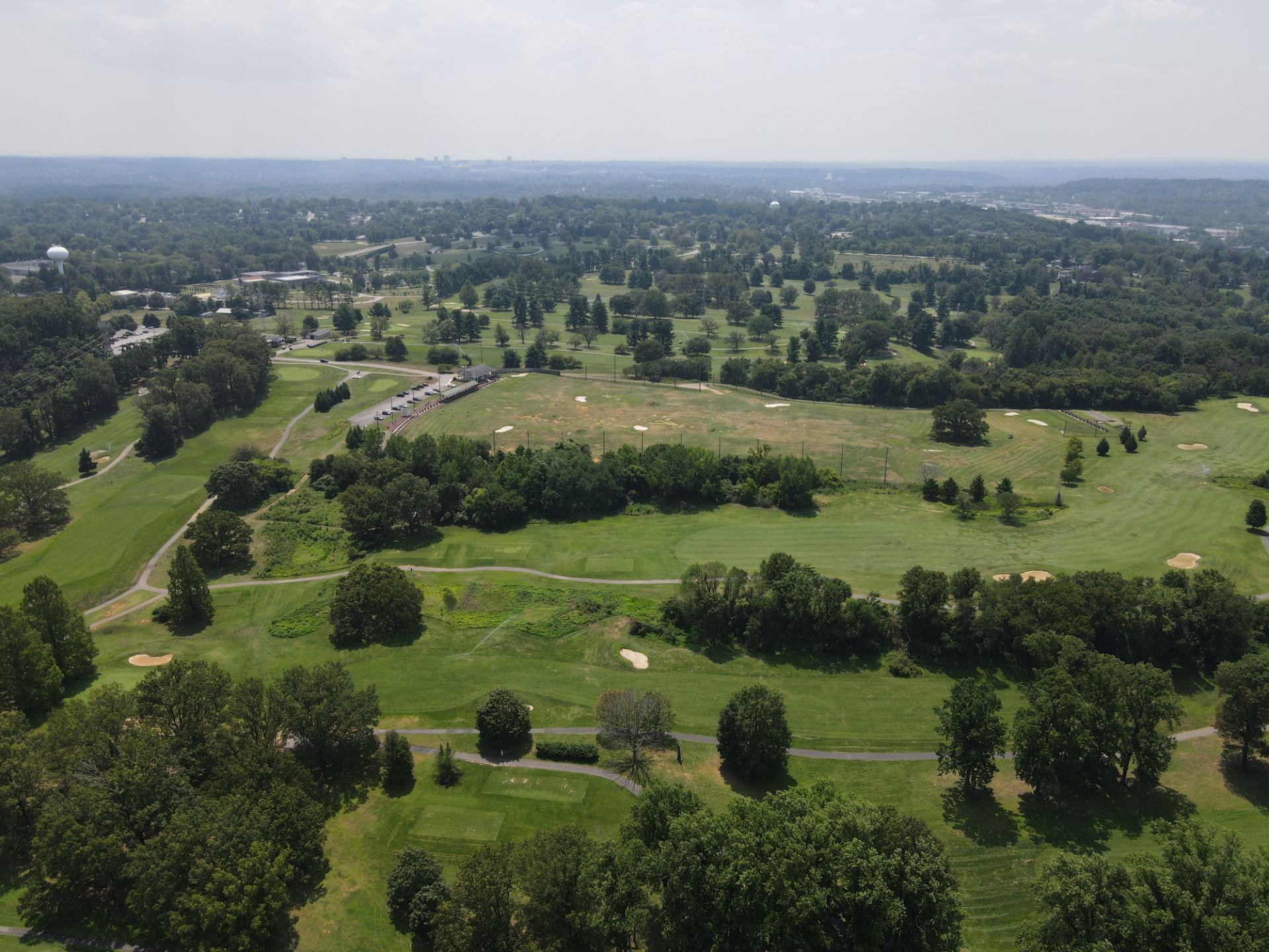
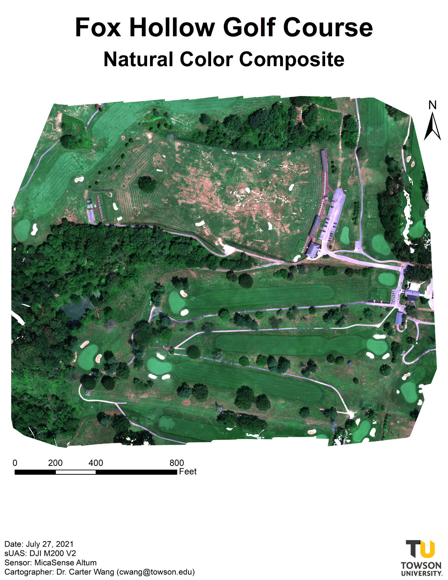
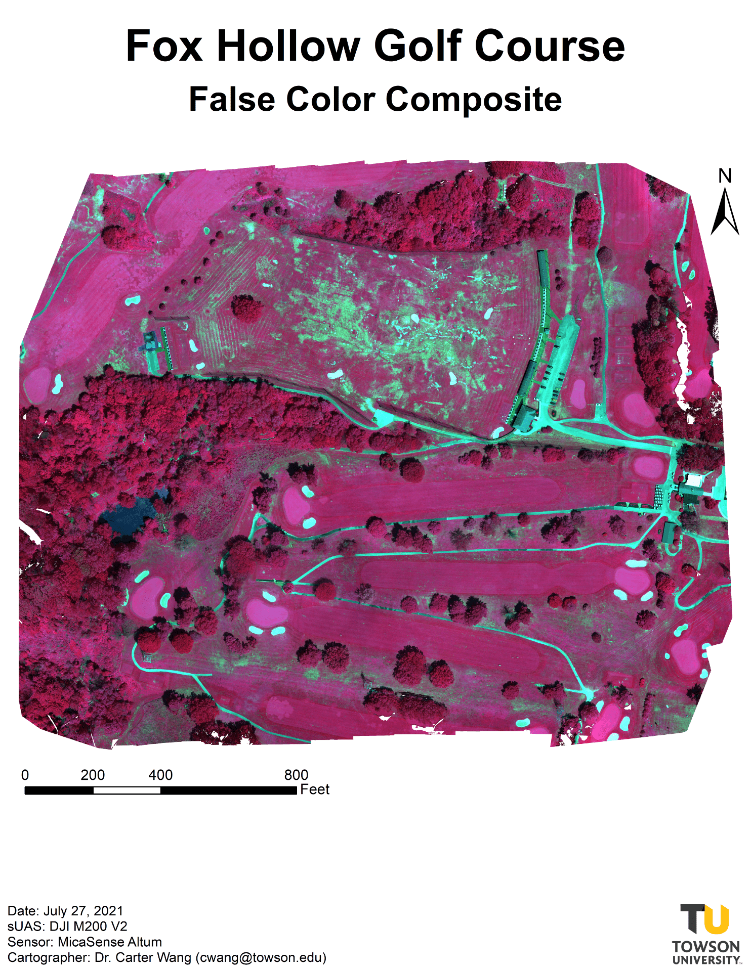
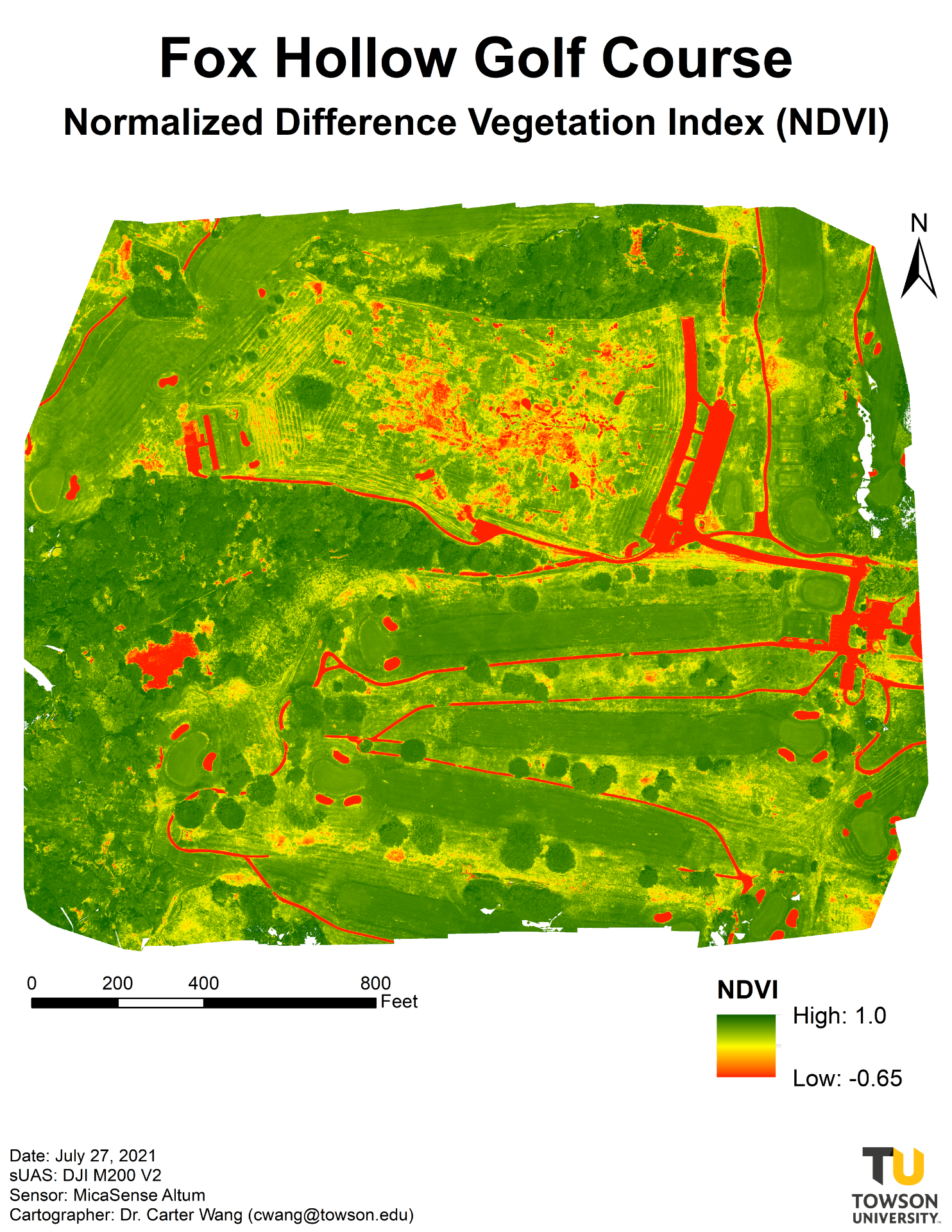
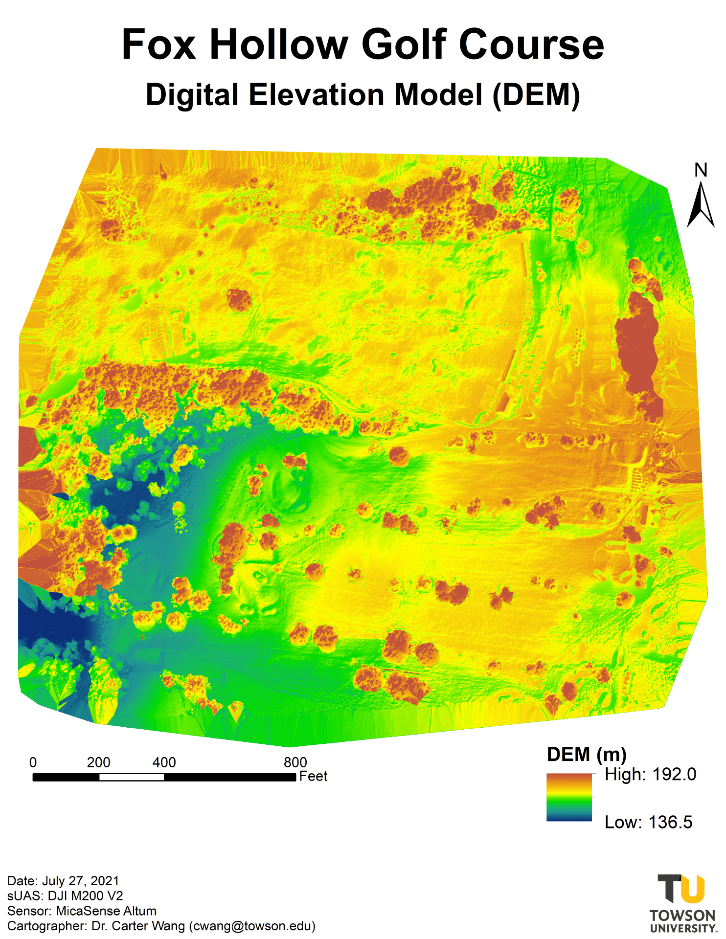
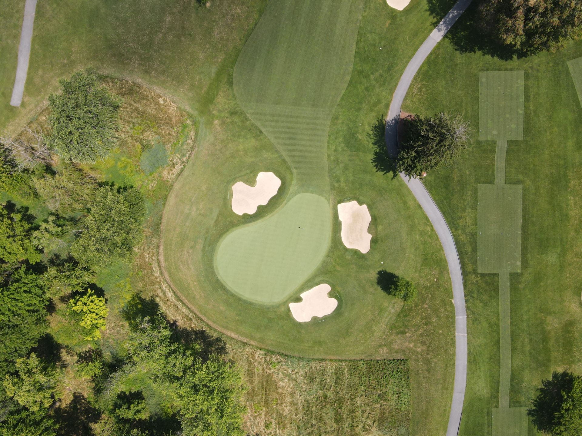
Fox Hollow Golf Course
Date: July 27, 2021
Location: Fox Hollow Golf Course
Device: DJI M200 V2 quadcopter, MicaSense Alt um multispectral sensor
Purpose: Obtain UAS imagery to evaluate grass conditions
Products: natural color composite, false color composite, NDVI image, surface temperature image, and digital surface model
Drone imagery of Fox Hollow Golf Course
Product imagery produced
Please click to view.
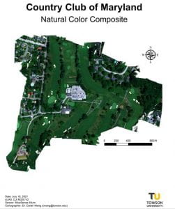
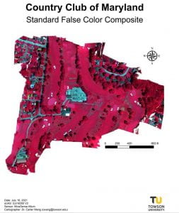
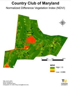
Country Club of Maryland
Date: July 16, 2021
Location: Country Club of Maryland
Device: DJI M200 V2 quadcopter, MicaSense Alt um multispectral sensor
Purpose: Obtain UAS imagery to evaluate grass conditions
Products: natural color composite, false color composite, NDVI image, surface temperature image, and digital surface model
Drone Imagery from the Country Club of Maryland


Product imagery produced


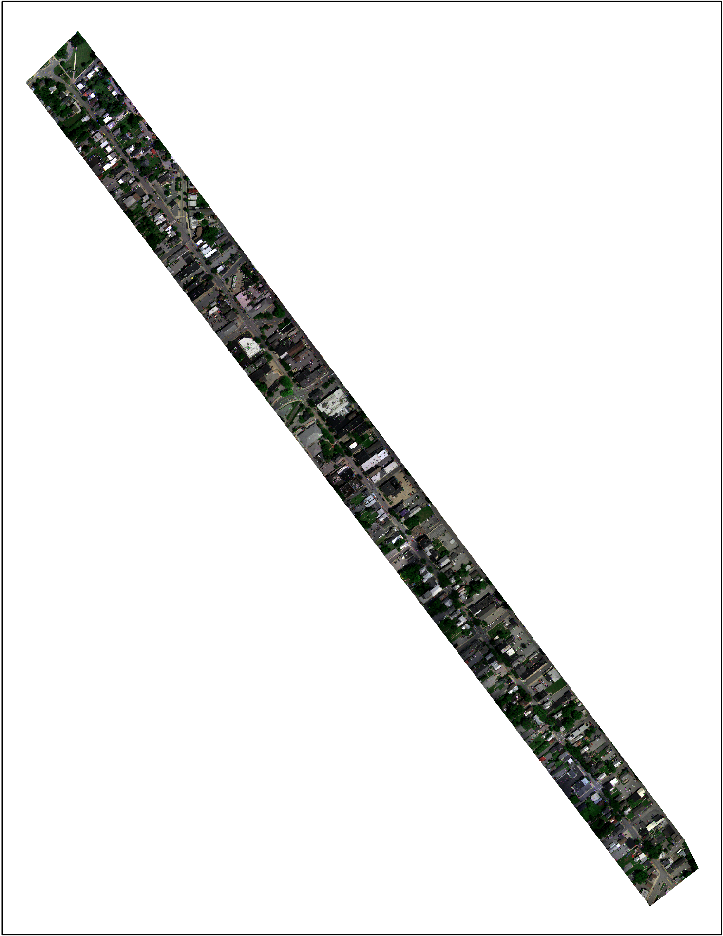
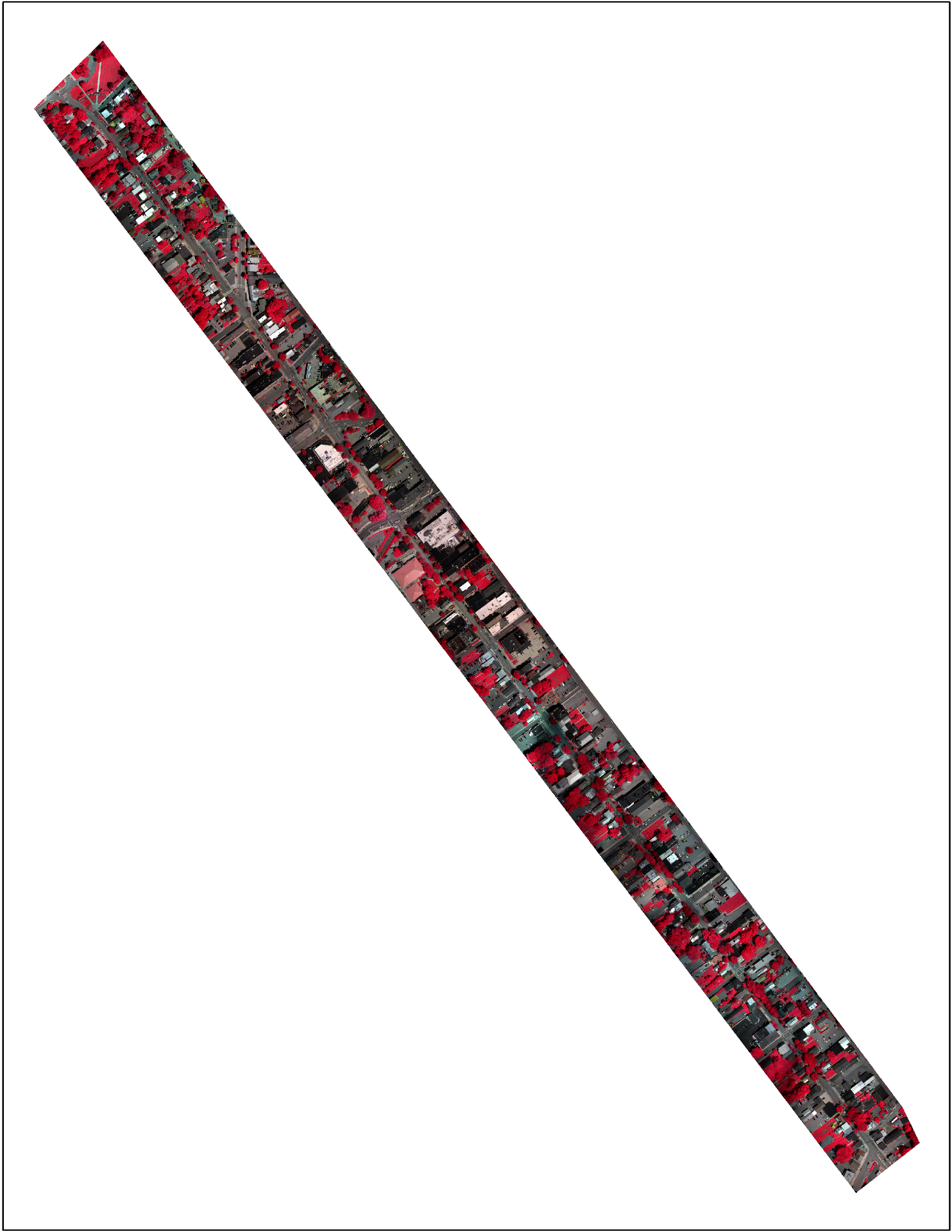
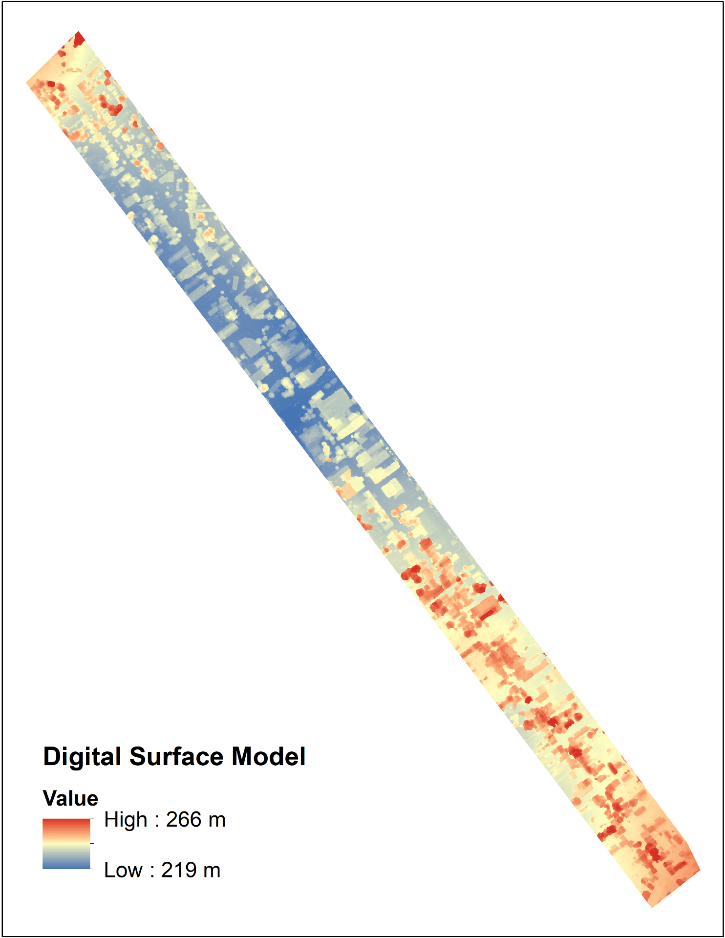
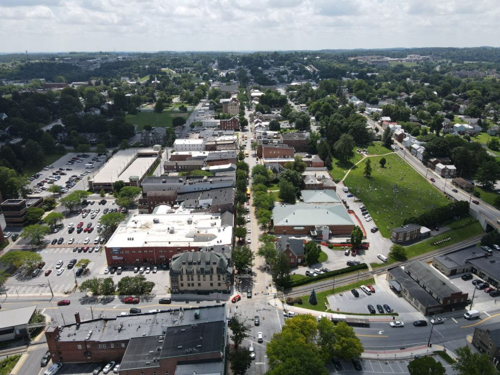
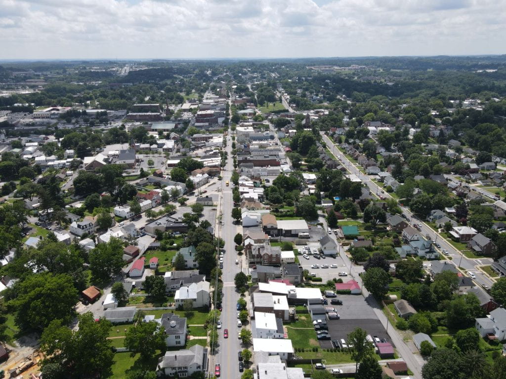
Westminster, MD
Date: July 13, 2021
Location: City of Westminster, MD
Device: DJI M200 V2 quadcopter, MicaSense Alt um multispectral sensor
Purpose: Obtain UAS imagery to evaluate the conditions of Main Street.
Products: natural color composite, false color composite, NDVI image, surface temperature image, and digital surface model
Drone Imagery of Main Street, Westminster, MD
Product imagery produced
Please click to view.