What is remote sensing?
Remote sensing refers to the collection of data about something without physical contact with the subject being studied. This geospatial technology is primarily used to study the Earth by using remote devices such as drones and satellites. The imagery collected can be used in many ways to help us better understand the world we live in. For example, analyzing satellite imagery of forested areas over time can show us how the areas have been impacted by deforestation, and at what rates deforestation has occurred.
The Remote Sensing Process
The remote sensing data-collection and analysis procedures used for Earth resource applications are often implemented in a systematic fashion referred to as the remote sensing process.
EMR Principles
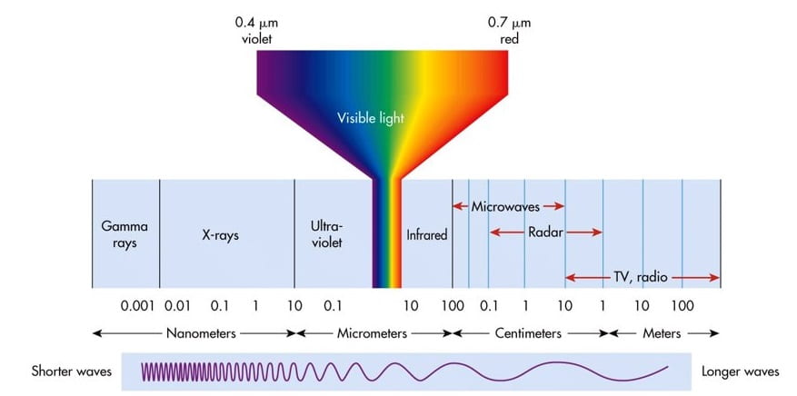
Electromagnetic Radiation (EMR) consists of radiant energy and is often represented using the electromagnetic spectrum, which organizes radiant energy based on the frequencies of their wavelengths. From most energetic (highest frequencies) to least energetic (lowest frequencies) the spectrum includes gamma rays, x rays, ultraviolet, visible light, infrared, microwave, and radio waves.
Platforms & Sensors
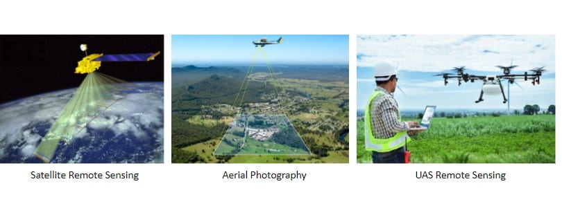
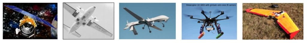
Remote sensing platforms fall into 3 categories: ground-based, airborne, and satellite.
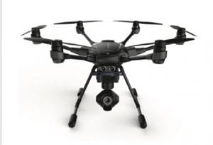
Ground-based platforms are typically instruments used to measure different types of information on the ground, such as reflected light. Typically though, these platforms are used to verify calibration of other platforms types. This includes unmanned aircraft systems (UAS). The U.S. Federal Aviation Administration (FAA) regulates the use of small unmanned aircraft systems (sUAS), UAS that weigh less than 55 points, for civilian use. There are a variety of places where you’re not permitted to fly sUAS for commercial or recreational use due to restricted airspace.
Airborne platforms include a variety of aircrafts that carry different equipment and fly at different altitudes. These types of platforms are good for acquiring high resolution imagery.
Satellite, or spaceborne, platforms are devices that are launched into space, where they remain in orbit around the Earth. Many satellites have been launched and more are launched every year. Each satellite has one of three types of orbits: geostationary, equatorial, and sun-synchronous. Each of these orbits has different purposes, pros and cons. For example, satellites with sun-synchronous orbits allow the satellite to pass over an area at the same local time. This is beneficial for observing changes to an area over time, but this orbit does not typically pass over polar regions so it should not be used for those areas.
NASA’s Earth Observing System (EOS) is a coordinated series of polar-orbiting and low inclination satellites for long-term global observations of the land surface, biosphere, solid Earth, atmosphere, and oceans.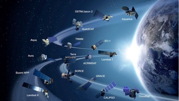
Landsat Program
Landsat is a satellite program governed by NASA and the U.S. Geological Survey. This program has launched 8 satellites to retrieve satellite imagery of Earth since its first launch in 1972. The next satellite, Landsat 9, successfully launched on September 27. 2021.
Landsat 9
The 2 instruments on board Landsat 9 are the Operational Land Imager 2 (OLI – 2) and the Thermal Infrared Sensor 2 (TIRS – 2). Major areas of concern that this satellite’s enhanced imagery will help address include deforestation, water use, coral reef degradation and more.
SENTINEL-2
SENTINEL-2, a 2-satellite mission from the European Space Agency (ESA), aims to develop imagery used for a variety of land studies.
The imagery captured by these platforms are products of their sensors, which may be active or passive. Active sensors emit their own radiation energy towards the subject, and the reflected radiation is measured by the sensor. While passive sensors measure the radiation that is naturally coming from the subject. Many different sensors are used because they are used to collect information at different wavelengths.
MODIS
MODIS, Moderate Resolution Imaging Spectroradiometer, is a sensor on board two NASA satellites: Terra and Aqua. The paths of these satellites allow Earth to be imaged every 1 – 2 days. The global scale of this imagery is ideal for observing large-scale events, such as land change over time. A complete list of products may be found here.
ASTER
ASTER, Advanced Spaceborne Thermal Emission and Reflection Radiometer, is a Japanese sensor on board the Terra satellite. This sensor has 14 bands, some with spatial resolutions as high as 15 meters. This high resolution instrument can be used for even greater detailed change detection. A complete list of products may be found here.
AVHRR
AVHRR, Advanced Very High Resolution Radiometer, is a sensor on NOAA satellites, NOAA 19 being the latest. Unfortunately, this sensor has started to degrade considerably and new products are not being created using this. However, previous data is still usable.
Additional Useful Educational Websites:
There are plenty of additional sources that can be used to explore the world we live in.
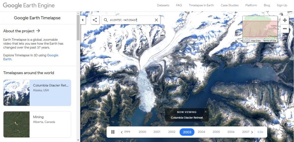
Google Earth Timelapse
Google Earth Timelapse combines remote sensing imagery with geospatial data, allowing you to explore how the surface of Earth has changed since 1984.
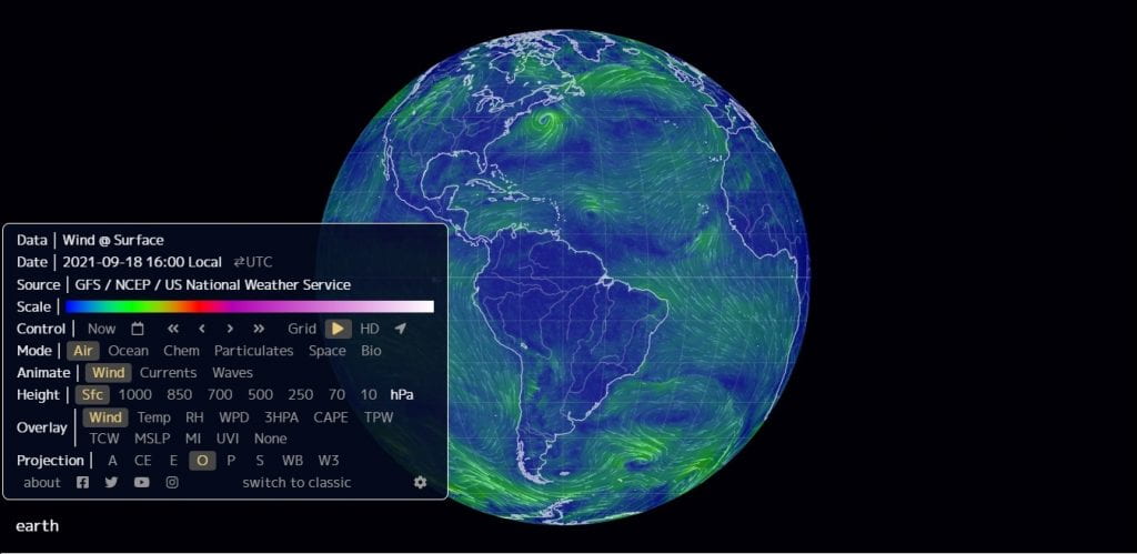
NullSchool Earth
NullSchool Earth provides and interactive Earth where you can explore a wide variety of topics such as wind, ocean currents, pollution levels, and more. This animated application can also be used to view conditions in the past.
Earth Image Puzzles
Courtesy of IndianaView, here a few virtual puzzles you can complete. Each features different scenes acquired from remote sensing. Click here to go to IndianaView’s full puzzle page to see all the puzzles!
Columbia River

Life Along the Nile

Central California Croplands

Niger Delta

Cascade Mountains, WA

Coral Reefs

Maryland
